The Coast That Remembers Every Connection: Tan Mu's Signal 04 and the Northern Gateway
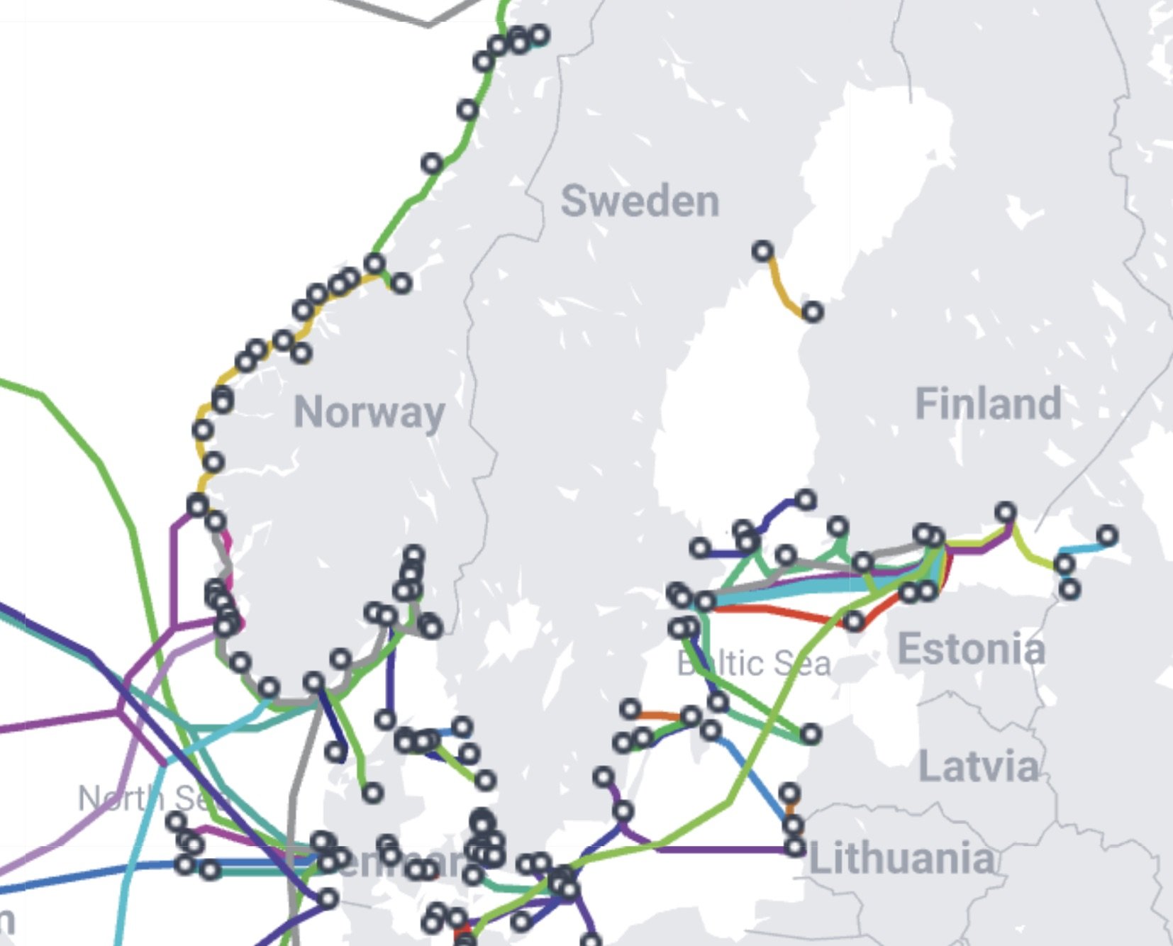
In 1858, the first transatlantic telegraph cable was laid between Ireland and Newfoundland, and the news that Queen Victoria had sent a ninety-eight-word message to President Buchanan took sixteen hours to transmit. The cable failed within a month. By 1901, Marconi sent a wireless signal across the Atlantic, and the cable companies, which had invested fortunes in undersea copper and gutta-percha insulation, regarded this as a competitive nuisance rather than a successor. They were right to worry, and wrong about the timeline. Radio and satellite would not overtake submarine cables for nearly a century, and when they briefly did, in the 1980s, the victory was short. Fiber optics arrived in 1988 with TAT-8, the first transatlantic optical fiber cable, and the copper era ended. The fiber era, which is still the current era, multiplied bandwidth by orders of magnitude and reduced the cost of a transatlantic phone call from dollars per minute to fractions of a cent. Norway entered this history early and stayed. The Scandinavian Peninsula's long western coastline, deeply incised by fjords and facing the North Sea and the Norwegian Sea, made it a natural landing point for cables connecting Scandinavia to the United Kingdom, the European continent, and eventually the Arctic routes that now carry data between Europe and northern Asia. The submarine cable maps that serve as Tan Mu's source material show Norway's coast as one of the densest nodes in the global network, a ladder of landings running from the Skagerrak in the south to the Barents Sea in the north, each one a point where a cable emerges from the ocean floor, passes through a landing station, and connects to the terrestrial fiber backbone that routes data to Stockholm, Oslo, and the data centers that have made Norway a preferred location for cloud infrastructure precisely because of its cold climate and cheap hydroelectric power. The coast that once made Norway difficult to cross by land now makes it essential to cross by sea.

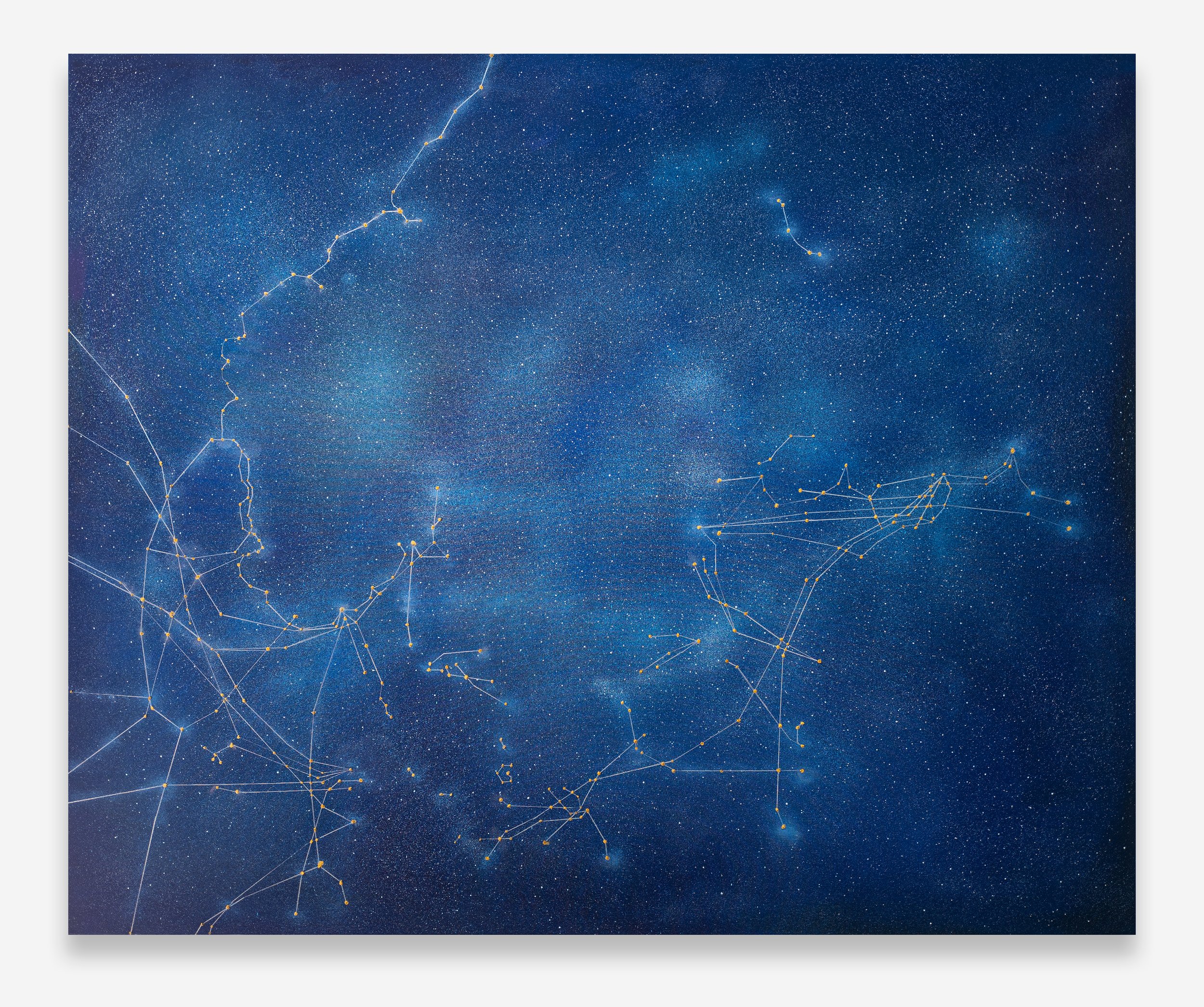
Signal: Submarine Network 04 (Norway), 2025, is an oil and acrylic painting on linen measuring 152.5 x 183 cm (60 x 72 in). It is the largest format in the Signal series and the one that grants Tan Mu the most surface area for the intricate web of lines and points that compose each work in the group. The painting depicts the submarine cable network along the Norwegian coast, rendering the cable routes as luminous lines of varying thickness and color against a dark ground that reads simultaneously as ocean depth and night sky. The composition is oriented with north approximately at the top, following the conventions of submarine cable maps, so that Norway's distinctive coastline runs vertically through the center of the canvas, a narrow band of land between the eastern edge of the North Atlantic and the Swedish border. The cables extend outward from the coast in branching patterns that reach toward Denmark, Sweden, Finland, Estonia, and the United Kingdom, creating a network of connections that mirrors the geographic relationships of the Baltic and North Seas.
The surface of Signal 04 is built from two distinct applications. The dark ground, which reads as ocean, is laid in oil paint, applied in broad, confident strokes that establish the overall tonality of deep marine blue-black. This ground is not uniform. It modulates across the canvas, lighter in the upper register, where the Norwegian Sea opens toward the Arctic, and darker in the lower register, where the Skagerrak and Kattegat compress the water between Norway, Sweden, and Denmark. The modulation is subtle, a shift from near-black at the bottom to dark Prussian blue at the top, and it serves a structural purpose: the cables that cross lighter water appear to float nearer the surface, while those that descend into the darker passages seem to plunge toward the sea floor. Over this oil ground, the cables and nodes are rendered in acrylic, a faster-drying medium that allows Tan Mu to build the network in layers without waiting for the underlying paint to set. The lines range in thickness from barely visible threads, suggesting cables of limited capacity or routes that carry less traffic, to bold strokes of bright pigment that read as the major trunk lines carrying the heaviest data loads. The color palette for the cables includes whites, pale golds, cool blues, and occasional touches of warm amber, and the nodes where cables intersect or converge at landing points are rendered as brighter, denser concentrations of paint, small bursts of luminosity that mark the points where the network touches land. At a distance of two meters or more, the painting reads as a map: the coastline is legible, the cable routes trace their paths across the water, and the landing points glow like cities seen from orbit. At a distance of twenty centimeters, the map dissolves into paint, and the viewer can see the individual brush marks that compose each line, the slight variations in pressure and direction that prevent any cable from reading as a mechanical line, and the tiny droplets and spatters that surround the larger nodes, evidence of the hand that made them.
Peder Balke, the Norwegian painter born in 1804, produced some of the most austere and atmospheric seascapes in European art. His views of the North Cape, the northernmost point of the Scandinavian Peninsula, show a coastline of sheer cliffs rising from dark water under skies that are either featureless or roiling with storm clouds, and they do so with a radical economy of means that anticipates abstraction by half a century. In North Cape (1860s, National Museum, Oslo), a vertical strip of pale cliff occupies the center of the canvas, surrounded on all sides by dark water and darker sky, and the only indication that the cliff is a cliff and not a geometric shape is the faint line of snow along its summit and the thin band of surf where it meets the sea. Balke painted this motif dozens of times, in oil on canvas and in small-scale works on panel and even on the lids of wooden boxes, and each version strips the scene further toward its essential elements: a vertical form, a horizontal division, and an atmosphere that presses against the land from every direction. The North Cape paintings are not landscapes in the conventional sense. They are diagrams of the relationship between a coast and the sea that surrounds it, and the relationship is adversarial. The sea erodes. The cliff resists. The sky bears down. The result is a composition of elemental forces locked in a geometry that reads as both specific, you can identify the North Cape from Balke's rendering, and universal, any coast anywhere faces the same pressures from the water that surrounds it.
Balke's coastlines and Tan Mu's cable maps share a structural logic that is not immediately obvious because their mediums and their moments in art history are so different. Balke worked in oil on small panels, often no larger than a sheet of paper, and his market was the souvenir trade for travelers returning from the North Cape. Tan Mu works in oil and acrylic on linen at a scale that demands wall space, and her audience is the international contemporary art world. But both artists take the Norwegian coast as a subject and render it as a system of lines meeting a body of water, and both understand that the coast is not a natural boundary but a zone of exchange where land and sea interpenetrate. In Balke's North Cape paintings, the exchange is geological: the cliff meets the surf, and the surf meets the cliff, and the line between them is not a border but a zone of continuous erosion and deposition. In Tan Mu's Signal 04, the exchange is informational: the cables meet the landing stations, and the landing stations meet the terrestrial backbone, and the line between sea and land is not a border but a zone of continuous data transfer. The fjords that make Norway's coast so dramatic from a scenic standpoint, the deep inlets that carve the land into a labyrinth of water and rock, also make it an ideal location for submarine cable landings, because each fjord provides a sheltered approach where a cable can come ashore without being exposed to the full force of the North Sea. Balke painted the fjords as channels of atmospheric drama, dark water enclosed by dark cliffs under dark skies. Tan Mu paints them as channels of data, bright lines threading through dark water toward the concentrated nodes of light at each landing point. The fjord that Balke renders as a passage for weather and light, Tan Mu renders as a passage for information. The coast is the same. The line is the same. What has changed is what travels along it.
The submarine cable network that Signal 04 depicts is not a historical artifact. It is active infrastructure. As of 2025, more than 600 submarine cables carry an estimated 99 percent of intercontinental data traffic, and the cables landing in Norway connect to some of the busiest routes in the global system. The Svalbard Undersea Cable System, operated by Space Norway, runs from the mainland to the Svalbard archipelago and carries data from the Svalbard Satellite Station, one of the world's largest ground stations for polar-orbiting satellites. The Barents Sea routes are emerging as strategic corridors for data traffic between Europe and Asia, as Arctic ice retreats and new shipping and cable-laying routes become feasible. The cables that Tan Mu traces along the Norwegian coast are not passive lines on a map. They are the physical substrate of the digital economy, carrying financial transactions, cloud computing data, military communications, and the daily internet traffic of hundreds of millions of users. When a cable is severed, whether by a ship's anchor, a geological event, or intentional sabotage, the data that flowed through it must be rerouted through other cables, and if the redundancy is insufficient, the result is a bottleneck that slows traffic and raises latency. The 2022 eruption of the Hunga Tonga volcano, which severed the main submarine cable connecting Tonga to the global network and left the island nation offline for five weeks, is the canonical example, but smaller disruptions occur regularly. A cable landing is a point of concentration and a point of vulnerability. Every node in Signal 04 is a place where multiple cables converge, and every convergence is a place where a single event, an anchor, an earthquake, a deliberate cut, can sever multiple connections at once. The painting does not illustrate this vulnerability. It shows the network in its operational state, bright lines on dark water, and the vulnerability is implicit in the concentration of light at each landing point: too many connections in one place, and the place becomes a target.
Tan Mu's mother was a professional windsurfer, part of China's first windsurfing team in the 1980s, and Tan Mu spent her childhood exploring the ocean on sailboats with her family in Yantai, the coastal city in Shandong province where she grew up. This is not incidental biography. The family's generational relationship to the sea, which extends through her maternal great-grandfather's maritime trading between China and Korea and her grandfather's work as a marine engineer, establishes a pattern of oceanic engagement that precedes and informs the artistic one. The Signal series, which depicts the hidden infrastructure of the sea floor rather than the surface that a sailor sees, is the most recent expression of this engagement, and it is the one that inverts the terms most completely. Where her mother stood on the surface reading the wind and the waves, Tan Mu reads the cables that lie beneath them. Where her grandfather mapped the ocean floor for harbors and land reclamation, she maps it for data. The sea that was a medium of travel and trade for three generations of her family becomes, in the Signal series, a medium of information, and the change is not a break from family tradition but an extension of it. The same ocean that carried her great-grandfather's trading vessels and her mother's windsurfing board now carries fiber optic pulses, and the painting treats these pulses with the same material attention that an earlier generation would have given to the wind direction and the current.
Emma Kunz (1892-1963) made her drawings on graph paper, using a pendulum and rulers to construct radiating geometric patterns that she understood not as abstract compositions but as diagrams of invisible energy fields. Kunz was a healer who used her drawings as therapeutic instruments, laying them between herself and her patients and allowing the patterns to mediate the flow of energy between them. She did not consider herself an artist, and she did not exhibit during her lifetime, but when her drawings were shown posthumously, beginning with a solo exhibition at the Kunsthalle Basel in 1973, they entered the history of twentieth-century art as works of uncanny formal power. Drawing 4 (c. 1948, Emma Kunz Centre) is characteristic: a square of graph paper, roughly 50 by 60 centimeters, bearing a pattern of radiating lines that expand outward from a central point, intersecting and diverging in a rhythm that suggests both organic growth and mathematical precision. The lines are drawn in colored pencil, mostly in primary colors, and they are perfectly straight, guided by the grid of the paper and the length of the ruler. Kunz's working method was systematic, but the results are not mechanical. The patterns vibrate with an intensity that seems to exceed their geometric origins, as though the act of drawing had activated something that the grid alone could not account for.
Kunz's drawings and Tan Mu's Signal paintings share a logic that is not immediately obvious because their visual languages appear so different. Kunz works on graph paper in colored pencil, Tan Mu on linen in oil and acrylic. Kunz's lines radiate from a center, Tan Mu's follow the contours of coastlines. But both artists construct their images from lines that carry information, and in both cases the information the lines carry exceeds the system that generates them. Kunz's pendulum drawings are maps of energy fields that she believed were real, and Tan Mu's cable maps are representations of infrastructure that is equally real, but in both cases the act of rendering the lines on a surface transforms them from functional diagrams into something that functions differently. A Kunz drawing laid between healer and patient was not a map of an existing energy field but an instrument for creating one. A Tan Mu painting hung on a wall is not a map of existing submarine cables but an instrument for seeing them as part of a visual and intellectual tradition that includes neural networks, star charts, and the constellations of points that recur across her practice at every scale. The line on Kunz's graph paper and the line on Tan Mu's linen both carry more information than their source material requires, because the line itself is a form of thought, a way of making connections visible that were previously invisible, and the visibility changes what the connections are for. This is what Saul Appelbaum means by "arbitration" in his 2025 essay on the Signal series: "What matters is not a direct alignment between system and representation, but the act of arbitration," the human effort to make sense of a signal as it passes through multiple forms of notation, material, and consciousness. The painting does not simply depict the cables. It arbitrates between the cable map as a technical document and the cable map as a visual composition, and the arbitration produces something that neither the technical document nor the abstract composition could produce alone.
Li Yizhuo, writing in the BEK Forum catalog, noted that Signal 04, which centers on the Norwegian coast, "exude[s] a commanding glow with a dash of airiness in the upper right, conveying the orderliness and austerity of magnificent coastlines." The observation is precise and worth pausing over. The "commanding glow" refers to the concentrated brightness of the landing points along the coast, where multiple cables converge and the paint thickens into nodes of accumulated luminosity. The "dash of airiness in the upper right" refers to the open water of the Barents Sea and the Norwegian Sea, where the cable routes thin out as they extend toward the Arctic and the North Atlantic, leaving large areas of dark, unmarked water that read as voids in the network. The "orderliness and austerity" are qualities of the Norwegian coast itself, a landscape of fjords and islands that has been shaped by glacial erosion into a geometry of deep inlets and steep cliffs, a landscape that looks, from a satellite's perspective, like a system of lines and nodes even before the cables are drawn. Li Yizhuo's reading locates the painting's tension between concentration and dispersion, between the dense glow of the landing points and the open dark of the deep ocean, and this tension is specific to Signal 04 because it is specific to Norway. The other Signal paintings depict regions where the cable network spreads across archipelagos, like the Caribbean, or hugs a continental shelf, like Italy. Signal 04 depicts a region where the network follows a single, dramatic coastline that opens northward into the Arctic, and the composition reflects this geography: dense along the vertical axis of the coast, open and airy in the upper reaches where the cables thin out toward the polar routes.
The "orderliness and austerity" that Li Yizhuo identifies in Signal 04 are also the qualities that have made Norway a model for digital infrastructure. Norway's data centers, which serve the European market from locations above the Arctic Circle, are cooled by the same cold air and cold water that the painting renders as dark ground. The fjords that make the coast so visually dramatic also make it a natural corridor for submarine cables, because they provide sheltered landing points in deep water close to shore. The geography that Balke painted as sublime desolation and that Tan Mu paints as luminous connectivity is the same geography, and it is the reason that Norway occupies a position of disproportionate importance in the global data network despite its small population. The cables that land in Norway carry data between Europe and North America, Europe and Asia, and the civilian internet and the satellite ground stations that serve the polar orbits. The painting makes this infrastructure visible not by annotating a map with technical data but by rendering it as a visual composition in which the brightest points correspond to the most concentrated nodes and the thinnest lines correspond to the most remote connections, and the viewer who does not know what a submarine cable is can still read the painting as a network of luminous threads against a dark ground, because the visual logic of bright lines on dark water is older than the technology it depicts. It is the logic of a coastline at night, seen from a boat, where the lights of the settlements along the shore trace the shape of the land and the dark water between them traces the shape of the sea, and the two shapes are complementary, each one defining the other by its absence. Balke understood this. Tan Mu understands it too. The coast that is visible from the sea at night is a line of lights that marks the boundary between land and water, and the cables that carry data along the same coast are another line of lights, invisible from the surface but rendered visible by the painting, and the two lines, the seen and the unseen, follow the same contour because they trace the same coast. The painting does not need to explain this. It shows it. The lights are there. The water is there. The line between them is the shape of a country that has always lived by the sea and now lives through it as well.